
AD

Please disable your ad blocker

Advertising helps us keep this website available. Please disable your ad blocker for this site, then reload the page.

Skip to content
CADsynthesis
  • CAD
  • BIM
  • GIS
  • CAM
  • CAE
  • ECAD
  • AI
  • Industry
CADsynthesis
Menu
  • CAD
  • BIM
  • GIS
  • CAM
  • CAE
  • ECAD
  • AI
  • Industry
Home/GIS & Geospatial

GIS & Geospatial

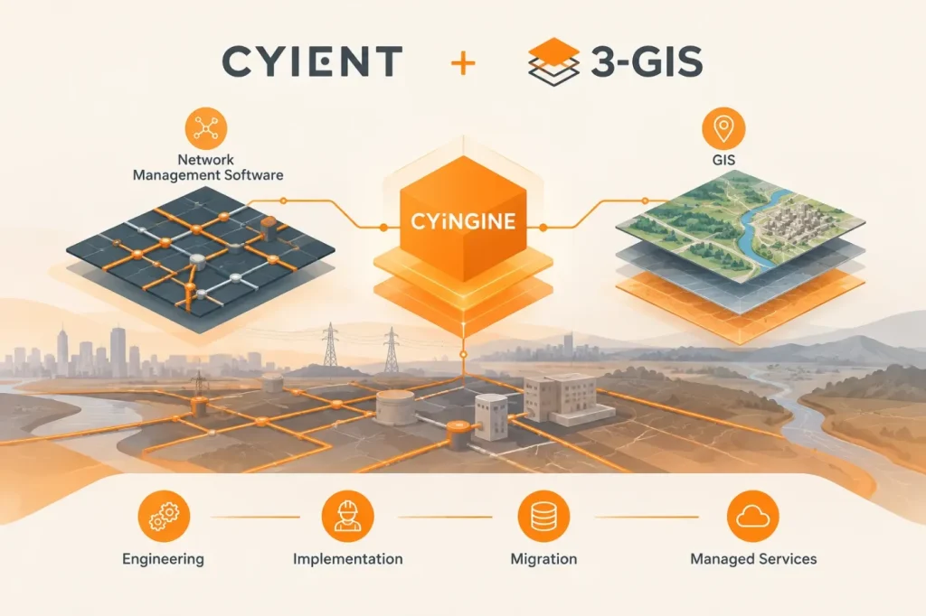
Cyient and 3-GIS Pair Network Software With CYiNGINE
GIS & Geospatial

Cyient and 3-GIS Pair Network Software With CYiNGINE

November 11, 2026

Cyient and 3-GIS will bundle network management software with engineering, implementation, migration and managed services. The planned CYiNGINE integration is described, but its technical details are not specified in the announcement.
UNSW’s MapAI Explore Launches for Natural-Language Spatial Analysis
GIS & Geospatial

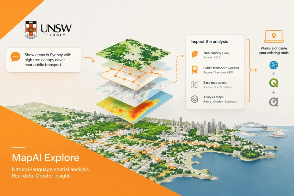
UNSW’s MapAI Explore Launches for Natural-Language Spatial Analysis

November 10, 2026

MapAI Explore lets users ask place-based questions in everyday language, then inspect the datasets and analysis behind the resulting maps. Its stated role is to accelerate repeatable GIS work alongside existing tools, not replace them.

RustGIS 0.2.0 expands GIS format support across desktop and browser
GIS & Geospatial

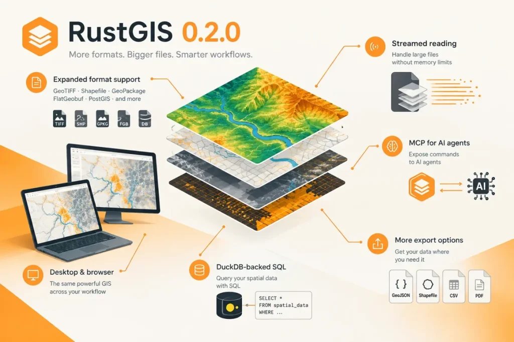
RustGIS 0.2.0 expands GIS format support across desktop and browser

November 9, 2026

RustGIS 0.2.0 widens its format support in the desktop app and browser, adds streamed reading for large files, and exposes commands to AI agents through MCP. The release also adds DuckDB-backed SQL and more export options.

Looq Adds West Coast Resellers and Trimble Connect File Transfers
GIS & Geospatial

Looq Adds West Coast Resellers and Trimble Connect File Transfers

November 9, 2026

Looq AI has signed reseller agreements with BuildingPoint Pacific and SITECH NorCal and demonstrated direct file transfers to Trimble Connect. The handoff can reduce manual uploads, but supported file types and Trimble licensing matter.

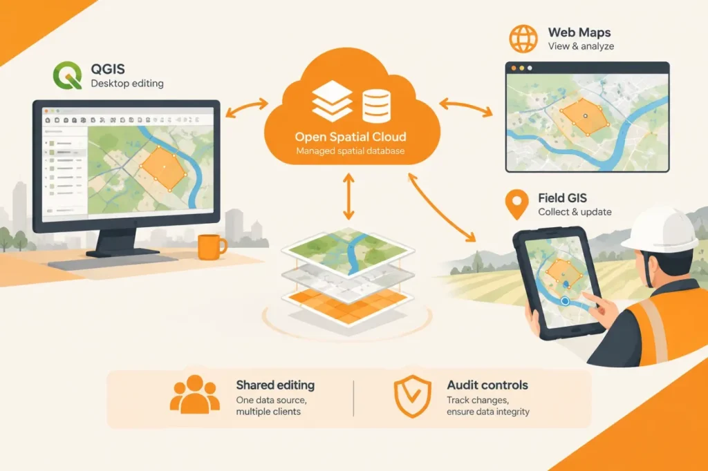
Open Spatial Cloud Connects QGIS, Web Maps and Field GIS to Shared Data
GIS & Geospatial

Open Spatial Cloud Connects QGIS, Web Maps and Field GIS to Shared Data

November 7, 2026

Open Spatial Cloud combines QGIS desktop editing with web and mobile GIS clients connected to a managed spatial database. The practical question for adopters is how shared editing and audit controls work across those clients.

SAM Acquires SSP Innovations and 3-GIS, Expanding Utility GIS and Network Software
GIS & Geospatial

SAM Acquires SSP Innovations and 3-GIS, Expanding Utility GIS and Network Software

November 6, 2026

SAM’s acquisition brings utility GIS consulting and network-management software into its geospatial and infrastructure-services business. The announcement describes complementary capabilities but does not specify a product integration roadmap.

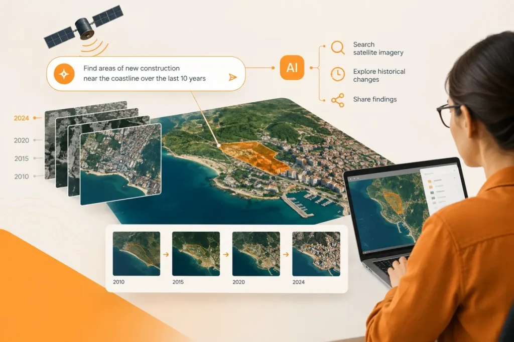
Planet AI App Searches Satellite Imagery Through Map-Based Chat
GIS & Geospatial

Planet AI App Searches Satellite Imagery Through Map-Based Chat

November 6, 2026

Planet’s AI app lets users search a decade of satellite imagery with natural-language prompts, then inspect historical changes and share findings. It is positioned as a discovery tool for geospatial analysis, rather than a replacement for GIS workflows.

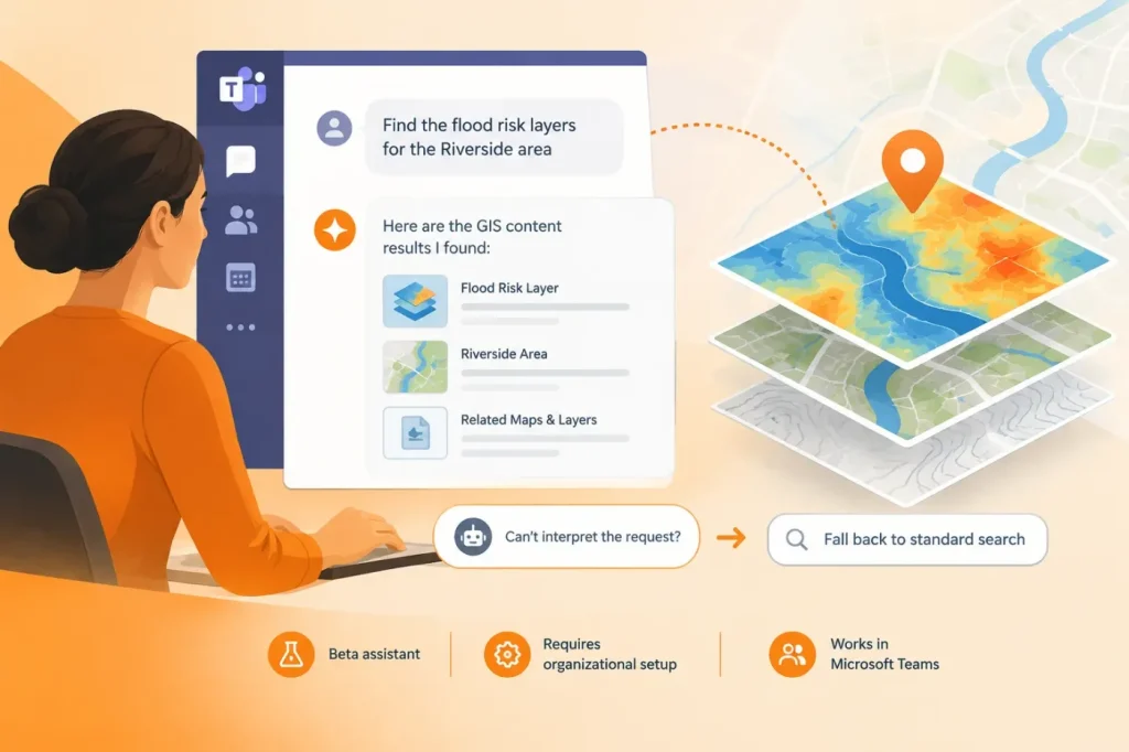
ArcGIS for Teams Adds Conversational Search for GIS Content
GIS & Geospatial

ArcGIS for Teams Adds Conversational Search for GIS Content

November 6, 2026

ArcGIS for Teams now supports natural-language queries to find GIS content in Microsoft Teams. The assistant is beta, requires organizational setup and can fall back to standard search when it cannot interpret a request.

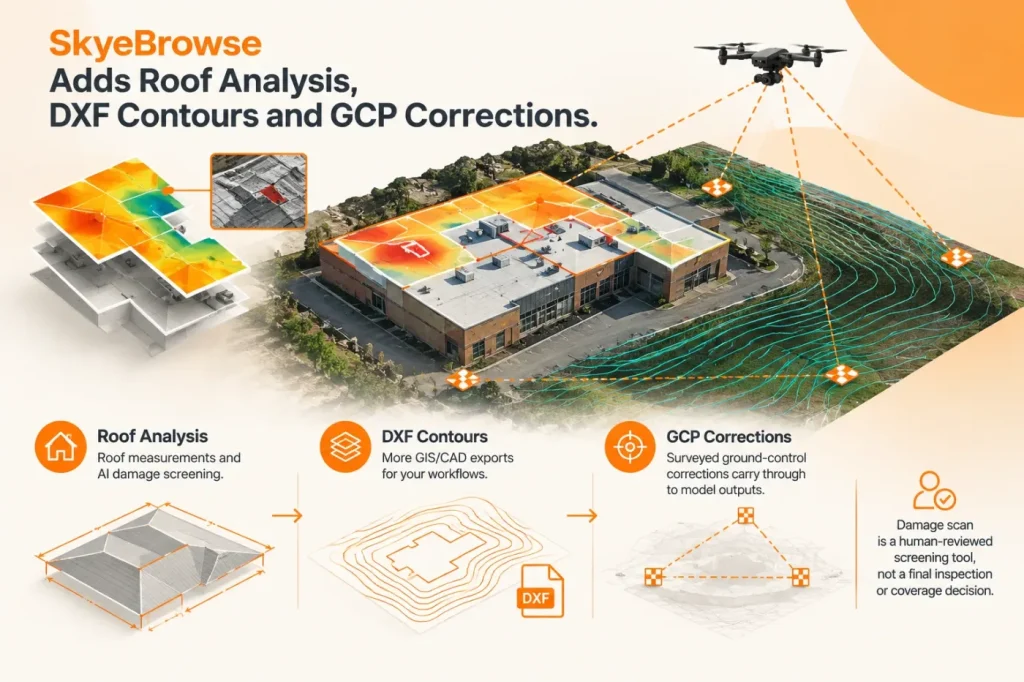
SkyeBrowse Adds Roof Analysis, DXF Contours and GCP Corrections
GIS & Geospatial

SkyeBrowse Adds Roof Analysis, DXF Contours and GCP Corrections

November 6, 2026

SkyeBrowse’s November 5 update adds roof measurements and AI damage screening, more GIS/CAD exports, and surveyed ground-control corrections that carry through to model outputs. The damage scan remains a human-reviewed screening tool, not a final inspection or coverage decision.

  • About
  • Terms of Use
  • Disclaimer
  • Cookie Policy
  • Advertising Disclosure
  • AI & Editorial Transparency
  • Corrections & Updates
  • Editorial Policy
  • Contact

Copyright 2026 CADsynthesis. All rights reserved