
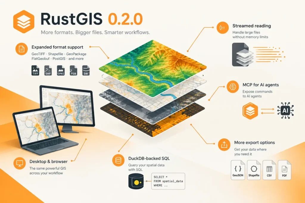

RustGIS 0.2.0 adds support for more geospatial data formats and streamed reading for large GeoPackage, GeoParquet and FlatGeobuf files. The project’s original release announcement also highlights DuckDB-backed SQL and an MCP server that lets AI agents run RustGIS commands and generate maps.
RustGIS is an open-source GIS application available for Linux, Windows and macOS and in a web app. The platform list does not state minimum operating-system versions, so check compatibility on target machines before standardizing a deployment.
More formats, including a route for CAD data
RustGIS opens common formats such as GeoJSON, Shapefile, GeoPackage and GeoParquet. GPX opens natively. Large GeoPackage, GeoParquet and FlatGeobuf files are streamed. The application can also open GDAL-supported formats such as File Geodatabase and DXF if ogr2ogr is installed; these are not described here as native formats.
That dependency matters for workflows involving CAD-world data: a team that needs to bring DXF into a GIS workflow must have ogr2ogr installed, rather than relying on RustGIS alone. The same requirement applies to File Geodatabase. Check for ogr2ogr on each machine that needs to open them before making those formats part of a repeatable process.
RustGIS also provides analysis tools such as buffer and clip, SQL-based selection, and guided workflows for tasks including viewshed analysis and finding the shortest path. The v0.2.0 release adds SQL queries through DuckDB Spatial.
Streamed reading: a practical trade-off
I see streamed reading as more immediately consequential than a longer format list for people inspecting large datasets: the reported detail is that RustGIS reads large GeoPackage, GeoParquet and FlatGeobuf files a view at a time instead of loading the entire file at once. The likely trade-off is lower upfront memory demand, not a guarantee of faster analysis; the release excerpt provides no comparative benchmarks. I would use this approach when whole-file loading is a barrier to inspecting a large dataset, but would require a local performance check before relying on it for repeated analysis. If that check does not meet the workflow’s needs, streaming alone is not a reason to adopt it.
MCP and the need to verify results
The MCP server lets agents such as Claude Code and Cursor run RustGIS commands and generate maps. A specific failure mode to guard against is an agent producing a map that looks plausible but reflects the wrong command or result. I would first give an agent a small, known dataset and a task with an expected spatial result, then inspect the output and compare it with that expectation. If the result does not match, I would not use the agent-generated map as evidence for the analysis.
RustGIS also includes a separate AI Assistant: a chat pane that can answer questions about data or run map commands. It reports that a change can be undone in one step, while commands that touch files or the network wait for approval. For that assistant, check that any required approval is granted and that the resulting change is correct before treating a workflow as complete; the one-step undo is a recovery option, not a substitute for verification.
Interface and workflow context
The interface uses a ribbon-based layout. RustGIS also has a command line that can render maps and chain tools, supporting repeatable workflows beyond the graphical interface. For teams considering it, the practical decision points are whether the required formats are supported directly or require ogr2ogr, and whether streamed reading and agent-generated results hold up against their own datasets and checks.
Sources
- RustGIS v0.2.0 announcement — opengeos / GitHub
- RustGIS v0.2.0 release notes — opengeos / GitHub
- RustGIS v0.1.0 release notes — opengeos / GitHub