
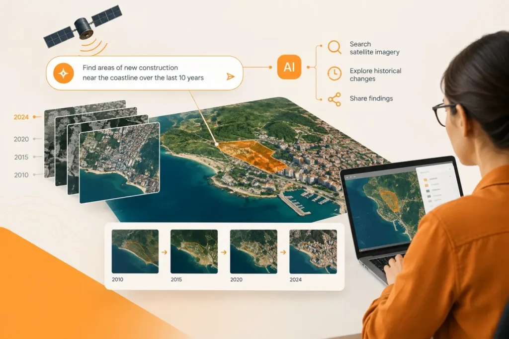

Planet’s new Planet AI app lets users search satellite imagery with everyday-language prompts, explore changes across more than a decade of archive data, and share map-based findings. The browser-based tool is available now, and Planet says access is currently free. Its practical promise is to help users find where to investigate without first knowing the location or navigating a conventional GIS interface.
Planet says the app interprets prompts with large language models and queries a searchable vector map built from visual features in its monthly mosaics. Users can then inspect imagery and compare locations over time, including side-by-side views or timelapses. The search index uses monthly mosaics; Planet’s broader Planetary Intelligence vision also refers to daily satellite imagery, but the launch announcement does not say that this app’s search index uses daily imagery.
From broad search to follow-up analysis
The app is designed to support early-stage exploration as well as follow-up tasks. Planet describes an option called Deep Research that deploys agents for more complex analysis. Users can also upload external images or CSV files, track trends regularly and schedule reports. The announcement does not detail the agents’ methods, supported file limits, reporting controls or a structured GIS export workflow, so those capabilities should not be assumed from the launch description alone.
Planet says beta users found the app useful when deciding where to begin an analysis. It also reports that environmental teams have used it to search for potential encroachment or fire threats, examine vegetation recovery and prioritize industrial sites near waterways. Planet claims some manual scanning workflows that took days can surface inspection targets in minutes. These are company-reported examples, not independently documented performance benchmarks; the announcement gives no test methodology or accuracy figures.
I see the strongest fit as a discovery layer, not a substitute for GIS analysis. A conversational search can help surface candidate locations across a broad area, especially when an analyst does not already know where to look. But monthly mosaics may miss changes that begin and end between mosaic intervals. Check the acquisition dates of the imagery behind a result; if the event may have lasted less than the monthly interval, use a higher-frequency source before drawing conclusions. Planet says results are grounded in imagery users can inspect, so that review should be part of the workflow.
Check the handoff before adopting it
For teams considering the app, the key practical question is how its findings connect to existing geospatial work. Planet says users can share snapshots and timelapses, but the launch announcement does not specify whether results can be exported as GIS features or transferred directly into another GIS package. I would make production use conditional on confirming a reproducible handoff into the team’s GIS workflow: if the workflow requires editable GIS features, shared snapshots or timelapses alone do not establish that requirement is met. That is an inference from the launch announcement’s stated sharing options and its lack of detail about GIS export.
The app is accessible on desktop and mobile, and Planet says users can sign up to explore it now. The launch announcement does not list supported browsers or operating-system versions, so teams should confirm compatibility for their devices before wider adoption. Planet also says users can sign in with a Planet Insights account to more easily access premium capabilities in the future, but does not specify those capabilities. Its design lowers the barrier to searching the company’s imagery archive, while leaving imagery review and downstream GIS work as important checks for professional use.
Sources
- Introducing the Planet AI App: Search. Explore. Act. — Planet Labs