
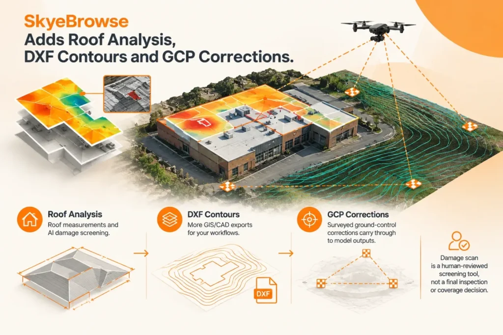

On November 5, 2026, SkyeBrowse announced Roof Damage Analysis, expanded 2D map and contour exports, and a change that lets users apply surveyed ground control points (GCPs) to correct a 3D model. For CAD, GIS and survey teams, the correction workflow is the most consequential change: the vendor says corrected coordinates carry through to measurements, annotations and downloaded files. SkyeBrowse’s announcement also details the roof tool’s limits and supported outputs.
From drone model to roof report
Roof Damage Analysis detects a roof in a SkyeBrowse model and calculates area, pitch, individual facets and roof-edge lengths, including ridges, hips, valleys, eaves and rakes. Users can edit the outline and generate a PDF with measurements, a roof diagram, photos, storm history and reviewer sign-off.
The AI scan examines up to 16 flight frames and eight photos, returning possible findings such as hail or wind damage for an inspector to approve or reject. SkyeBrowse describes it as a screening aid; it does not determine damage cause, insurance coverage or repair requirements. My recommendation is to use its findings to prioritize closer review, not to treat a clean scan as proof that a roof is undamaged: the scan reviews a bounded set of imagery, and each report finding still requires human approval. The vendor’s feature page describes the workflow and its review controls.
Survey corrections and CAD/GIS handoff
The GCP change moves beyond checking model accuracy. Users can designate surveyed points as control or check points and apply a vertical offset, 3D shift or seven-parameter correction. According to SkyeBrowse, the correction propagates to the point cloud, mesh, measurements, annotations and downloads; check points remain outside the fit so they can provide an independent accuracy check.
That propagation is useful because correcting only a displayed model while leaving measurements or exported data unchanged would create a risky handoff. I consider the separate check points essential, not optional: teams should assess residuals against them and confirm the project’s coordinate system and height datum before using corrected data for design or survey deliverables. SkyeBrowse also cautions that its contour elevations run from the scan’s lowest ground, so users need to tie them to their datum before design work.
The release adds DXF contour exports alongside DTM GeoTIFF and ground LAS outputs. Its 2D map export workflow offers destination-specific files for ArcGIS, Google Earth, AutoCAD Civil 3D, Global Mapper and SARTopo/CalTopo. This can reduce conversion steps for mapping and civil workflows, but compatibility does not by itself establish survey accuracy or suitability for a particular project specification.
Availability and practical scope
SkyeBrowse says Roof Damage Analysis, GCP corrections and topographic exports are available on Pro and Public Safety & Enterprise models; 2D map export is available wherever downloadable 2D maps are supported. The company has announced the capabilities, but the announcement is not an independent accuracy validation. For teams adopting the correction workflow, the practical test is whether independent check points meet the project’s tolerances after correction, not simply whether the model aligns visually.